
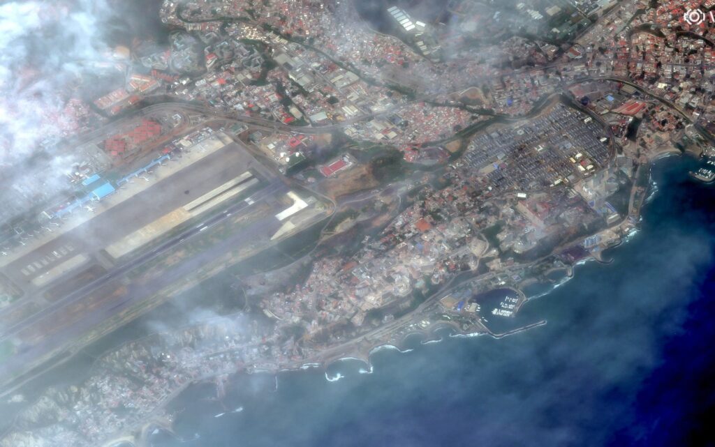
Satellite imagery has provided a stark comparison of Venezuela’s coastal city of La Guaira before and after it was struck by a pair of powerful earthquakes. The twin quakes have caused significant disruptions and visible damage across the region, altering the landscape and infrastructure of this vital coastal hub.
La Guaira, an important port city in Venezuela, lies strategically on the country’s northern shore along the Caribbean Sea. Known for its bustling port activities and coastal tourism, the city has been vulnerable to natural disasters due to its location near seismic fault lines.
The satellite images released allow for a detailed analysis of the earthquake’s aftermath, showcasing the areas most affected by the tremors. Pre-event images highlight the city’s infrastructure, including densely packed buildings, road networks, and port facilities, all appearing intact.
However, the post-quake imagery reveals stark contrasts. Many buildings show signs of structural damage, with some completely collapsed. Key transport routes have been disrupted, and there is noticeable debris scattered across various neighborhoods, indicating the intense shaking experienced during the seismic events.
Officials have utilized these satellite images to coordinate emergency response efforts, prioritizing rescue operations and relief distribution to the worst-hit areas. The visual data assists in assessing damage quickly and accurately, especially in locations where ground access remains challenging.
The twin quakes occurred within a short span, compounding the challenges for residents and emergency services. The psychological impact on the local population has been profound, with many displaced from their homes and requiring urgent assistance.
International aid agencies have responded to Venezuela’s call for help, and the satellite data is instrumental in planning logistics for aid delivery. This technology aids in overcoming communication barriers and difficult terrain that often inhibit timely response in disaster zones.
Experts warn that as Venezuela continues to be situated in a seismically active zone, the risk of future earthquakes remains high. Ongoing monitoring through satellite technology will be essential in mitigating the effects of such events.
Beyond immediate disaster response, the satellite images will also help urban planners and engineers design more resilient infrastructure and improve disaster preparedness in La Guaira.
In conclusion, while the twin earthquakes have caused substantial damage to La Guaira, the availability of before and after satellite images has vastly improved the ability to understand, respond to, and plan for such natural disasters. This approach highlights the critical role of modern technology in enhancing resilience and safeguarding vulnerable coastal cities against future seismic threats.