
a-wide-town-street-is-severely-flooded-with-deep-murky-brown-water-reflecting-an-overcast-sky-as-a.jpg
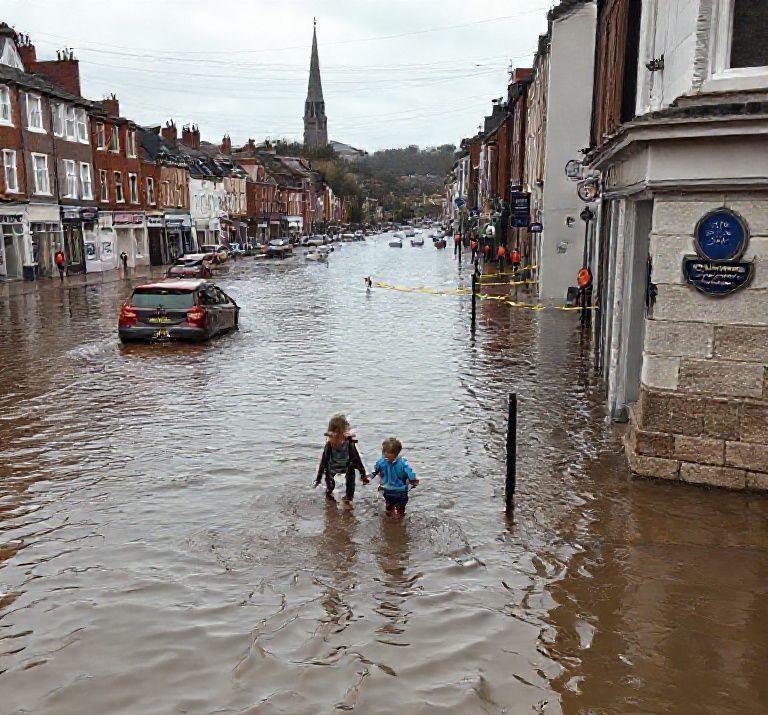
The United Kingdom is bracing for widespread flooding and significant disruption as a month’s worth of rain is forecast to fall across large swathes of the country within a 24-hour period on Monday. Millenium TV can confirm that severe weather warnings are in effect, with an amber alert issued for south Wales indicating the highest risk.
Forecasters anticipate between 20 to 40mm (0.8 to 1.6in) of rain will fall widely across south Wales, with some south-western facing hills potentially receiving closer to an astonishing 120mm (4.7in). This intense rainfall, combined with already saturated ground, raises the specter of extensive flooding, widespread transport disruption on both road and rail networks, potential power outages, and the risk of communities becoming isolated. Authorities have also cautioned about the danger to life from fast-flowing or deep floodwaters.
Beyond the amber warning, numerous yellow weather alerts are active across many western areas of the UK. These include warnings for south-west Scotland until 21:00 GMT on Monday, north-west England and parts of the West Midlands until 23:59 GMT, and most of Wales and south-west England until 21:00 GMT. Within these regions, similar rainfall totals of 20 to 40mm are expected, though higher elevations such as the Cumbrian Fells and Eyri could see between 80 and 120mm (3 and 4.7in), leading to localized flooding and further travel chaos.
This comes as parts of East Yorkshire have already experienced flooding early Monday morning, requiring emergency services to pump water from properties. Strong winds, including gales along coasts and over high ground, are also predicted to accompany the heavy downpours. Regarding safety, a spokesperson from a national environmental agency emphasized, “We urge people not to drive though flood water – it is often deeper than it looks and just 30cm (1ft) of flowing water is enough to float your car.”
The current wet conditions mark a remarkably soggy start to winter, following a November that has been exceptionally wet across England and Wales. Data indicates that rainfall up to November 29th was 132% of the normal average. Certain areas in eastern England have even recorded their highest November rainfall on record. For instance, Bridlington in Yorkshire received nearly three times its typical November rainfall, with 180mm compared to an average of 66mm. Other parts of East Yorkshire and Lincolnshire have similarly experienced their wettest November on record, with more than double their usual rainfall.
© Millenium TV