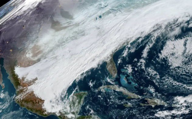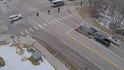
An enormous winter storm that began late on Tuesday over the middle of the country was bringing its messy mix of snow, ice and rain to the Northeast on Friday, canceling flights and making for treacherous travel conditions, as it made its last gasp before pulling in another blast of Arctic air behind it.
More than 14 inches of snow were recorded across a vast area, stretching from Illinois to Maine. One of the highest snowfall totals came out of Webster, New York, located near Rochester along Lake Ontario, with a total of 21 inches, according to the National Weather Service.
Burlington, Vermont, set a new daily snowfall record on Thursday with 6.5 inches of snow, breaking the 112-year-old record for Feb. 3, set back in 1910, of 6.2 inches. The city wound up with a total of 15 inches from the storm spanning Thursday and Friday.
Bangor, Maine, set a daily snowfall record on Friday. Bangor recorded 11.4 inches of snow which shattered the old daily record of 9.6 inches set in 1990. The city had not recorded a double-digit daily snowfall total in nearly 4 years, but has now recorded two in the past two weeks.
In the wake of the storm, snow coverage for the contiguous United States reached its highest point so far this winter. The storm spread snow from the southern Rockies to northern New England, resulting in 50.7% of the contiguous U.S. being covered in snow, according to the National Oceanic and Atmospheric Administration (NOAA), as of Friday.
As the temperatures in the atmosphere fluctuated from above freezing to below freezing, there were areas that received a mix of winter precipitation, like freezing rain and sleet.
As water droplets fall toward the ground, they encounter a layer of below-freezing air. This is what determines if there is sleet or freezing rain. If there is a thick layer of cold air above the ground, the raindrops freeze into balls of ice, known as sleet, before reaching the ground. In extreme cases, sleet can accumulate several inches, similar to snow.
The highest sleet totals were in New Philadelphia, Ohio, and Meddybemps, Maine, where 4.5 inches of sleet was measured Friday morning.
If there is a very thin layer of cold air above the ground, the water droplets do not have enough time to freeze before reaching the surface. Instead, the water droplets freeze after contact with the surface, glazing everything with a layer of ice.
The highest freezing rain reports came out of northeastern Pennsylvania with 0.80 of an inch measured in the town of Lake Ariel, just outside of Scranton. Right behind that was nearby Springbrook Corner, Pennsylvania, with a total of 0.78 of an inch of freezing rain.


