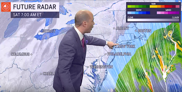
The blizzard of January 2022 will go down in the history books after shattering records and delivering heavy snowfall from the mid-Atlantic to the Northeast. Southeastern New England was among the hardest-hit areas, with snowfall totals topping 30 inches in Stoughton, Massachusetts, and wind gusts over 100 mph in Wellfleet, Massachusetts.
But behind the scenes, years of combined experience, education and forecasting led to an accurate forecast ahead of the storm. A success story like this forecast serves as a good reminder on National Weatherperson’s Day as to why AccuWeather meteorologists wanted to make a career out of studying the atmosphere and making incredibly complex forecasts.
While the average meteorologist will forecast more winter storms in their lifetime than they can count on both hands, a major storm like this will be unforgettable. Here are some of those memorable moments, told by none other than the meteorologists who were at the center of what was a most complicated forecast. Below is an oral history of the forecasters’ thought processes in the days leading up to the ferocious blizzard and what it was like for them to finally watch the storm unfold after days of predictions.
Jonathan Porter, Chief AccuWeather Meteorologist: In a situation like this, we know a lot of people are relying on [AccuWeather], and it makes us treat big storms like it’s the Super Bowl. Just like a team would prepare for the Super Bowl, we’re going to do the same kind of thing. We’re going to prepare for making sure that we’ve got every angle covered and we’ve thought about every possible aspect of the storm.
According to an AccuWeather analysis, this winter storm affected more than 105 million people from Florida to Maine. In comparison, 91.63 million people watched the Super Bowl in 2021, according to Sports Media Watch.
Bernie Rayno, AccuWeather Chief On-Air Meteorologist: I’ve been doing this for 30 years, and I think the feeling of anxiety and obsession hasn’t changed one bit. The reason I use those words is because this is where your reputation is won and lost. When you have an East Coast snowstorm, this is where reputations are won and lost.
East Coast snowstorms are notoriously challenging to forecast due to all of the changing factors and large population. The placement of the center of the storm can have a big effect on how many people are impacted. Often, meteorologists refer to the “40/70 benchmark,” which is where 40 degrees north latitude and 70 degrees west longitude meet. If the center of the storm tracks to the west of this benchmark, it is likely that the highly populated I-95 corridor will receive mostly rain and the heaviest of the snow will be farther inland. If the center of this storm tracks to the east of the benchmark, then the I-95 corridor will receive snow. The amount of snow depends on the strength of the storm.
Mary Gilbert, AccuWeather Meteorologist: Forecasts, especially for all these big storms, can be tough especially when [the storm is] impacting such a wide area. Our big mission here at AccuWeather is protecting lives and property, so we want to make sure that our forecasts not only are accurate, but people are actually able to interpret them and use them to make decisions about these bigger storms.
Dan Pydynowski, AccuWeather Senior Meteorologist: There’s always an empathy side of it. The storm disrupts people’s lives, and there are always negative consequences of it.


